Point Nemo
This expedition was to reach Point Nemo, otherwise known as the Oceanic Pole of Inaccessibility. This is the point which is furthest from dry land in any direction. The closest land to Point Nemo is 2,688 kilometres away! Take your choice from Pitcairn Islands, Moto Nui in the Easter Islands, and Maher Island in Antarctica
The closest humans to Point Nemo are usually the astronauts on board the ISS (International Space Station) which is a 'mere' 415 kilometres from the pole.
Visiting Point Nemo - Full video
The name "Point Nemo" comes from the Latin word 'nemo' which means 'nobody' in English. The name was chosen by a Croatian survey engineer, Hrvoje Lukatela, who was studying ocean currents at the time and named the point after Captain Nemo from Jules Verne's Twenty Thousand Leagues Under the Sea. He used a geo-spatial computer program that incorporated the planet's ellipsoid shape to calculate the point furthest from land.
It was thought that Nemo is so remote that "it is unlikely that anyone will ever visit it". Well, we proved that wrong!
Listen to Talk Radio interview after reaching Point Nemo.
Point Nemo Location
The coordinates of Point Nemo are Latitude 48°52.6'S, Longitude 123°23.6'W.
Here is a map of its location between the bottom of Chile and New Zealand
The closest continent is Antarctica, at around 2,700km south of this Oceanic Pole of Inaccessibility. Similarly, the closest Earth-bound habitation can be found at Pitcairn Island to the North East, also around 2,700km away. If you are interested in more stats, the ocean floor is around 4,000 metres at nemo and the average water temperature is just 7.2°C.
Nemo also sits in an area called The South Pacific Gyre which is complex system of rotating currents in the Pacific; a convergence of The Antarctic Circumpolar Current, the Humbolt Current and the West Wind Drift. As a result, lots of oceanic debris, that is rubbish, gets caught in the system and makes this area of the Pacific a sort-of oceanic garbage patch :-(.
There are believed to be no fish or other marine life in the area with the lack of nutrients making it difficult for even the hardiest species to survive. Currently, only bacteria and tiny crabs have been discovered to live in the volcanic vents on the seafloor near Point Nemo. Scientists have described it as "the least biologically active region of the world ocean".
Adding to the problem is the fact that this remote place has also been chosen by various nations to dump their space debris, such as the Russian Mir space station. Or, as it is politely termed, "destination for decommissioned spacecraft". Obviously, it is unlikely to hit anything in such a remote location.
Note to self: take a helmet!
How we got to Point Nemo
Having considered several different ways of getting to Point Nemo, such as via racing yachts, or diverted cargo ships, we hit on the idea of using an expedition boat called the Hanse Explore.
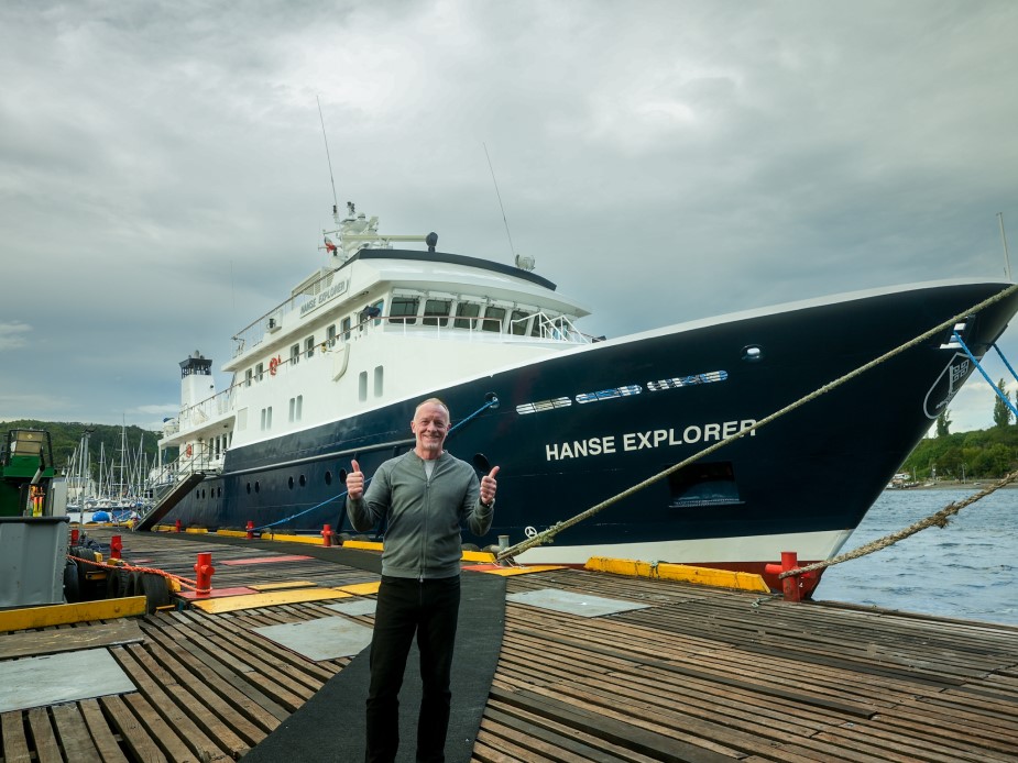
This ship is a true expedition yacht with advanced navigational equipment which will be helpful locating our exact position.
Normally the Hanse Explorer is used to take people to and from the Antarctic, due to its high Ice Class and steel hull. We took advantage of the repositioning of the craft after its Antarctic 'season' to get us to Point Nemo. Her engines run on light marine gas oil, which means it has a low environmental impact, and a bunker capacity for up to 40 days at sea or 8,000 nautical miles.
We boarded the Hanse Explorer on 11th March 2024, and set sail in the early hours of the 12th and expected the trip to Point Nemo to take around 10 days.
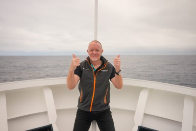
Immediately we were thrust into our first South Pacific storm with winds of 40mph and 6 metre waves. It wasn’t an ideal situation for me or Mika; neither of us have particularly good sea legs and we were basically confined to lying on our beds in our cabins for around 48 hours. I’ll spare you the details!
Suffice to say that if you ever want to lose weight rapidly, get on a boat below 40 degrees south.
Captain Andriy Bratash steered us as far north of the storm as he could to avoid the very worst of the head-on waves and eventually the situation started to abate.
And on the third day they ate again, lol.
One of the reasons for setting off when we did, instead of waiting out the storm, was the forecast for conditions at Point Nemo. He’d spotted that there was a weather window at the Pole which would allow us to deploy the Zodiac RIBs and to possibly get into the water. If we were late arriving, Nemo would be in the centre of a hurricane force storm.
Its hard to describe just how remote Point Nemo is. Yes, I can throw stats at you, but its still hard to imagine sailing for 10 days and not seeing anything else apart from sea all the way to the horizon for so long.
Around 4,200km later we duly arrived in the vicinity of the Oceanic Pole of Inaccessibility. The hurricane was just ahead of us, but waves had “only” started to reach 2.5-3m in height. It was still safe to launch the Zodiacs and possibly get into the water.
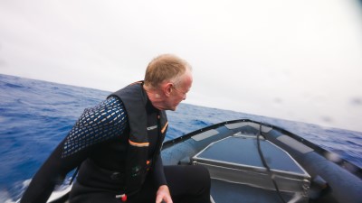
At all the other Poles of Inaccessibility I’ve visited; I’ve taken a photo stood at the exact spot. That wasn’t going to be possible this time. So, I thought “Why not go for a swim?”
At about 3pm local time we donned wetsuits (remember the water temp is below 10 degrees Celsius), jumped aboard the zodiacs and set off for the exact coordinates of Point Nemo, the small RIBs being more manoeuvrable than the Hanse itself.
Once on the spot, I flipped off the edge into the sea and duly became the first person to swim at Point Nemo.
As I’ve said above, we can’t claim to be the absolute first people to arrive exactly at Point Nemo. Maybe somebody else has inadvertently also been through the same coordinates, or maybe they haven’t. Certainly, there doesn’t seem to be and definitive proof of that happening. But what we did was remove any doubt as to if someone had been there.
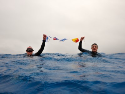
While we (Mika, Adam the videographer, and myself) were in the water we surprised to see how many seabirds started to congregate around us. This was a pleasant sight to start with because Nemo is thought to be in an area of very low biodiversity possibly with no fish in the area. But the presence of the seabirds would seem to indicate enough fish for them to eat. And, on departure from the point we even spotted a flying fish.
I say “to start with” because the situation rapidly turned against us. One of the albatrosses seemed to take a dislike to us being in his or her territory. If you’ve never floated next to an angry Albatross, let me tell you not to try. They are imposing bids, weighing around 12kg but with a wingspan of around three metres! Their bill is large, strong, and sharp-edged, with the upper mandible terminating in a large hook.
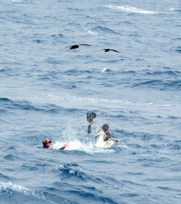
Short swim completed and photos in the bag, we returned to the zodiacs and left the sea to Mr Angry and Co.
The rest of the expedition was just about avoiding the worst of the hurricane and heading northwards out of the tempestuous winds and seas of the Southern Pacific.
Point Nemo Flag
I needed a flag for Point Nemo, so I could “float” at the exact coordinates for Point Nemo holding the official flag. The only problem being that there wasn't one. There are various flags for Pacific nations and some for collections of islands like the Pacific Community flag. However, all of these represent islands and the whole concept of Nemo is that it ISN'T anywhere near an island.
So i decided to create a flag for Point Nemo. Being a location in the sea, I thought that maritime flags would be apt. So we created a string of bunting joining the maritime flags that spell out the word N.E.M.O.
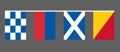
The Point Nemo Flag
Nemo Day
Nemo Day or Point Nemo Day is 20th March each year
