Antarctica
No trip to Antarctica is ever going to be easy to plan or execute. But this idea, to reach the Pole of Inaccessibility for Antarctica, was always going to be a Grandaddy of Expeditions. Little did I know that Covid and a relentless procession of storms would make it even more challenging than initially perceived.

Planning The Expedition
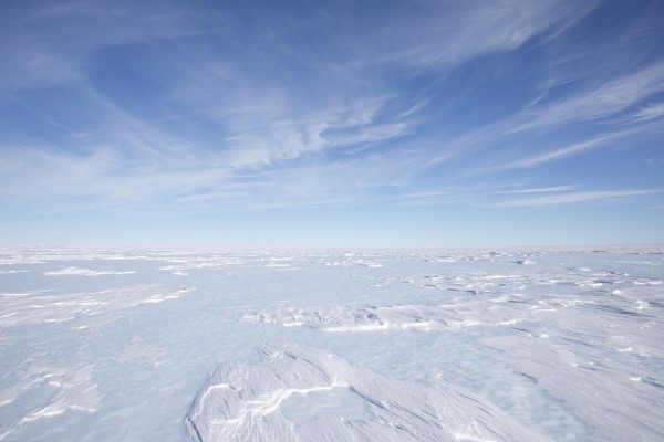
Typical view in Antarctica!
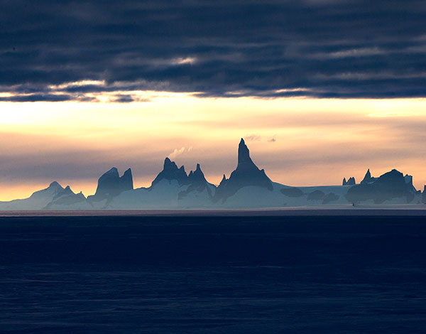
Wolf's Fang Mountain - 140 miles away
Having been to the regular South Pole in 2016 with guides from a company called White Desert, I thought they would be a good starting place for advice. After all, Patrick Woodhead, CEO of White Desert is the person who introduced me to poles of Inaccessibility in the first place.
Between 2016 and 2019, White Desert had grown in influence in Antarctica, becoming a logistics hub for the many scientific outposts on the continent as well as running a carbon-neutral adventure business.
We considered different methods for getting from White Desert's centre of operations at Wolf's Fang (Latitude: 71°31.4304'S, Longitude: 8°48.3923'E) to the Pole of Inaccessibility (PIA):
- Manually walking to the pole, pulling a pulk with our own food and shelter.
- Utilising the Traverse Team – this is a tractor team of machines most people call piste bashers, that take fuel and equipment from ships to the science teams on Antarctica.
- Driving from Wolf's Fang to the pole in 'Arctic Trucks'.
- Flying to and from the pole in a De Havilland Twin Otter.
All of the options had pros and cons, all were going to be very risky and all were going to be horrendously expensive.
After much consideration, and running of numbers, we reached the conclusion that the swiftest and safest route would involve utilizing a Twin Otter plane stationed at the Wolf's Fang base. This choice was motivated by the fact that the Twin Otter was among the few aircraft capable of landing at the altitude of 3700 meters without the need for a prepared landing strip. Our plan involved a refuelling stop at 78° South on the plateau to assess performance at altitude, followed by another refuelling at 83° (Dixie Camp) before making the final push to the PIA.
| Twin Otter Aircraft with skids | |
| Excess weight stripped from aircraft | |
| Expert Pilots | |
| Bespoke fuel dump |
| Blood Oxygen testing kit | |
| Portable Oxygen Cylinders | |
| Cold Weather gear for -50°C | |
| Weather window of at least 2 hours |
The next decision was which 'version' of the Antarctic Pole of Inaccessibility should we target? There were three possibilities:
- The 'traditional' PIA, where the Russians set up a base in 1958. This is known as the 'Historic Pole of Inaccessibility' and sits at Latitude: 82°06'S, Longitude: 54°58'E where they left a bust of Lenin to mark the spot.
- The coordinates calculated by the British Antarctic Survey in 2005 based on refined mapping of continental Antarctica ignoring ice shelves at Latitude: 82°53'14″S, Longitude: 55°04'30″E
- Similar coordinates that take the ice shelf into consideration (in 2005) at Latitude: 83°50'37″S, Longitude: 65°43'30″E.
I decided that option 1 would be the best even if the coordinates would not be so accurate. The decision was made because the old Russian base is what most people know or think-of as the Antarctic PIA. Also, the Guinness Book of records acknowledges expeditions passing via that point. And, lastly, there would be more to see there (i.e. the Lenin bust and an abandoned comms mast).
Naturally we also wanted to get to the 'proper' PIA, which would be option 2, but that was set as a secondary target.
| Cold | |
| Wind | |
| Lack of weather forecasts | |
| No landing strips |
| Weight restrictions | |
| Altitude | |
| Limited rescue opportunities |
It's pretty obvious that The Cold is a major issue in Antarctica, even though our expedition would be scheduled for the Antarctic 'summer' in January. The average temperature at the PIA is a chilling -58.2°C.
With no relief above the ice shelf on the plateau, the winds can reach high levels fairly regularly.
The PIA is just short of 900km from the South Pole (nearest scientific base), meaning there is no reliable weather forecast for the region. We would have to rely on satellite images and expert local knowledge to interpret the charts.
Obviously, no landing strip exists at the PIA, which we've already noted is at an altitude of 3,700m. So, the TO was going to have to make its own landing strip by first 'touching' the surface with the skids to determine the friction, then making another two passes to 'flatten' the ice and to make a firm landing zone.
Apart from making the air rarefied and thus needing a longer distance to take off, the altitude posed a problem to us, the passengers, with the TO not being pressurised, so we were going to need to take our own oxygen bottles along to stave off Hypoxia.
Weight is a major consideration. The TO needed enough fuel to get to and from the PIA, but needed to keep the weight down in order to be able to take off at the high altitude.
Finally, we had to consider what would happen in the event of a crash. Given we'd be in the only aircraft capable of getting to the PIA, we would be relying on a surface vehicle rescue setting out from the South Pole. Since that would take around eight days, it would probably be 'Game Over'.
First Expedition
Having arrived at Wolf's Fang despite the last tentacles of Covid causing issues with any form of air travel, we analysed the weather forecast and identified a weather window about seven days after landing, with a storm being forecast for the first week.
However, we also had two days of good weather before that storm arrived. So, we took the Twin Otter to Atka Bay to view a colony of Emperor Penguins – fatal mistake.
On the way back from Atka, the TO developed a fault with one of it's generators which would later prove catastrophic for the entire expedition.
The camp was then struck by the most significant summer storms witnessed in Antarctica for over 17 years, characterized by winds averaging 90mph and reaching gusts of more than 120mph – akin to a Category 4 hurricane. It was also quite odd that the storm brought in a lot of snow. Antarctica is known as The White Desert because it doesn't normally precipitate.
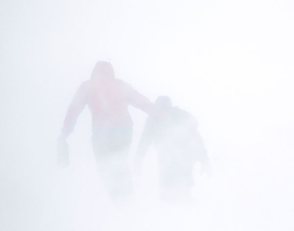
Visibility dropped to less than 2 metres in the storms
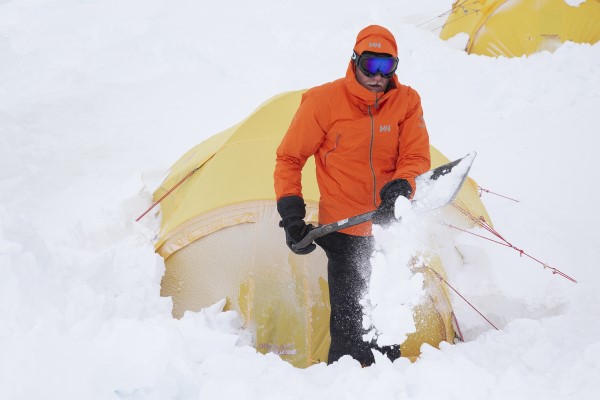
Digging out the tents
That storm further damaged the Twin Otters with snow getting into the engines. When that was cleared out, several electrical relays blew and there weren't enough replacements. Spare parts had to be flown in from Canada, a process hindered by ongoing Covid-related disruptions.
What followed seemed almost surreal – a flight delay caused by a NOTAM (Notice to Airmen) due to a missile test in a zone 1500km wide, isolating Antarctica from South Africa.
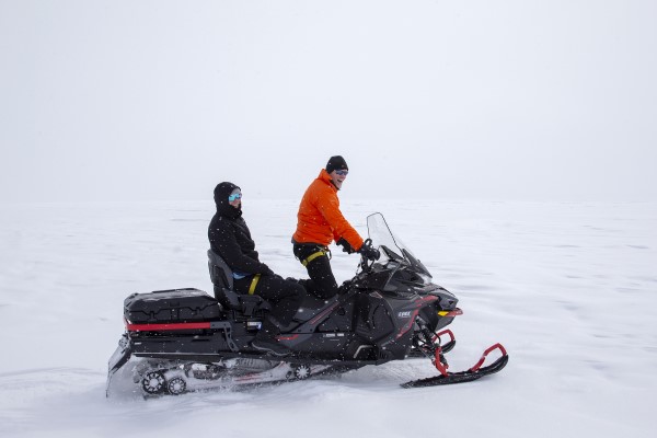
Moving between camps
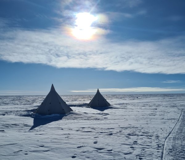
Antarctic Camping
This was followed by another, much-smaller storm.
The next flight, supposedly bringing our parts, turned into a 'boomerang flight' unable to land due to low visibility (which was only present for 45 minutes but enough to run the plane out of fuel).
The flight after that was cancelled due to covid amongst passengers.
Then another big storm hit. This one 'only' averaged 50mph with gusts rising to around 80mph, but it hung around for five days.
Fresh food had long since run out and the heating elements in tents and around camp were failing - the snow was causing issues with the exhausts, since they aren't designed for precipitation.
When the next attempted flight also boomeranged due to a faulty warning light, we decided to call a halt to the whole expedition. Covid and weather had defeated us.
So, after 28 days stuck on the ice, when the next flight finally did land, we jumped on it and returned home with our tails between our legs.
"It'll be cold. There's not much Oxygen. Don't die."
Second Expedition
Whoever is in charge of these things must have looked down and said, "I really dumped on those guys last year, so I'll give them an easier ride this year".
We'd made a couple of changes to the plans based on the previous failure, but also luck seemed to go our way on this second attempt.
- We decided we would stay in Cape Town until a very firm weather window was available, with no intervening storms. We'd spent more than enough time holed up in a tent while winds caused havoc.
- The Twin Otter would do nothing between us leaving Cape Town and setting off on the PIA expedition.
- We would 'drop' one passenger from the plane and replace them with an extra fuel barrel, thus giving us a better chance of getting to our secondary objective if things went our way.
During prep, we had even joked that if we had to get off the plane taking us onto Antarctica and straight onto the TO, then we would do it. Little did we know, that would actually happen!
Two hours after landing and after a frantic repacking of our cold weather equipment, we boarded the Twin Otter – myself, my son, Mika, two pilots, Pete Pender and Cody Brandl, and one engineer, André Martineaux. The wise words from Wolf Fang's resident Doctor were ringing in our ears, which summarised as "It'll be cold. There's not much Oxygen. Don't die."
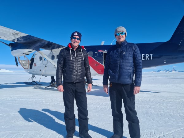
Bouncing straight onto the Twin Otter
just 2 hours after arriving
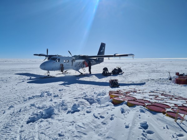
Improvised fuel dump
Luke, the operations manager at White Desert, had pinpointed two potential weather windows for a possible landing. Both windows were just two hours wide on Wednesday, the 11th, and Friday, the 13th. Considering the prevalent Western superstition associated with Friday the 13th, we collectively agreed to prioritize the first window on the 11th and designate the Friday as a contingency plan.
A few hours after take-off from WF we came in to land at the 'new' fuel dump created just for this trip at 78° South.
The Traverse team who put the fuel in place had thoughtfully worked up and down a few times to make a rudimentary landing strip. Even so, the Twin Otter was thrown all over the place. To call it a bumpy landing was a gross understatement.
Next up was Dixie Camp at 83° South where we overnighted in hostile temperatures. The landing there was thrown into jeopardy at the last moment when the visibility dropped close to the minima for the craft. Would we be able to take off the next day? What would it mean for the landing at the pole?
In the morning, if you can call it that since there was no darkness at that latitude in January, we awoke to bright, sunny skies with little wind. Our attempt at the Pole was ON!
A few hours later we arrived at in the vicinity of the pole and the weather was holding. Oxygen was free flowing for all on board; the pilots needed to be on top form and we'd just come up from sea level.
Pete and Cody took us down for the first touches of the ice; what was the friction going to be like? Certainly, the blaring alarms and rattling teeth made me, with no flying experience, think it might be touch and go.
The second pass went much the same as the first. Vision was blurred with the bumps and alarms were buzzing in our ears. Then the engine noise abruptly changed. The pilots had decided they could handle the situation and just slammed the bird down. We had landed about 7km from the base coordinates.
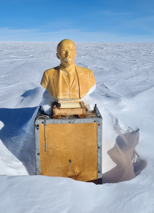
Lenin Bust at the old Soviet Base
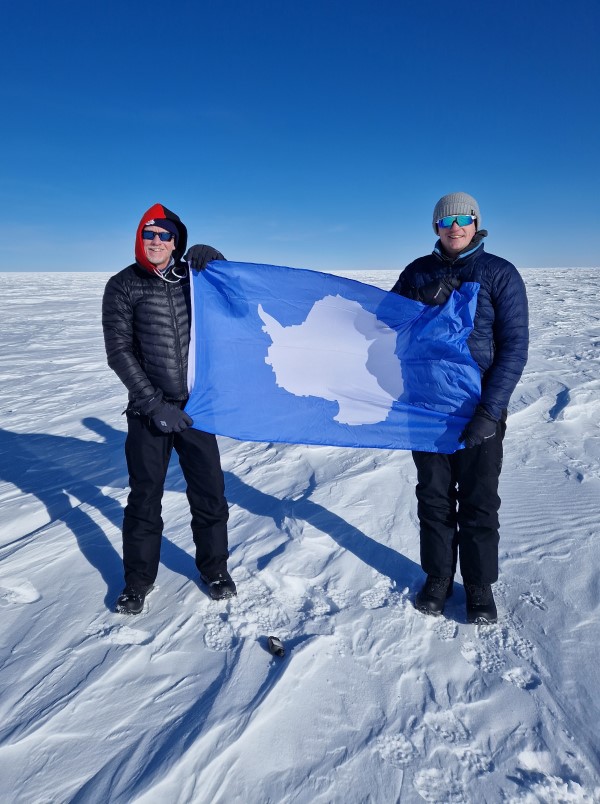
Stood at the Antarctic Pole of Inaccessibility
The Twin Otter then turned into an Antarctic taxi, driving across the surface of the wind-blown ice towards the pre-programmed destination (82°06'S, 54°58'E). But as we approached, the taxi changed direction. The pilots had spotted something sticking out of the ice – Lenin – we'd arrived!
In our wildest dreams we'd thought we would jump out of the plane in howling winds and very low visibility, with a few moments to stand at the actual pole, grab a photo or two before getting back into the plane caked in ice. But it couldn't have been more different. The sun was still shining, the wind was relatively low and the temperature was 'only' -28°C. As a result, we ended up spending about 30 minutes looking around.
The actual coordinates of the bust are now Latitude: 82°06.7017'S, Longitude: 55°02.0340'E – about 1.7km from the original coords. The difference could be down to ice movement and inaccurate coordinates being measured by the Russians in 1958.
Given the 'ease' of this first landing, Cody and Pete said it was game-on for landing at our secondary objective, the BAC-calculated coordinates of the Antarctic Pole of Inaccessibility.
Not long later we were celebrating again as we took photos at Latitude: 82°53.2326'S, Longitude: 55°04.5010E. Only the second recorded group to ever reach this location after a three-man Spanish Transantarctic Expedition in 2005.
